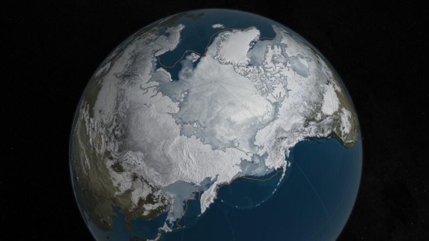
The Arctic had an extremely warm winter this year, and the latest satellite images from NASA reveal the lowest levels of winter Arctic sea ice on record.
NASA scientist Walt Meier uses satellite images of Arctic sea ice in his research.
“It’s about two Texases less ice now than it used to be back in the late seventies,” Meier said.
Meier said it’s not just area – the ice is also about 40 to 50 percent thinner.
Arctic sea ice melts in the summer and builds during winter. Around March, the ice is at a peak for the year.
This year’s winter sea ice levels are lower than the previous record set in 2015.
Sea ice is frozen ocean water and distinct from the ice that forms on land, such as ice sheets and glaciers. Polar ice reflects sunlight and helps keep the regions cool.
“And that balance between the cold pole and the warmer regions like in Arizona, that helps set up weather patterns,” Meier said.
Meier said dramatic changes in sea ice alter this equation.
“The Arctic’s not like Las Vegas, what happens in the Arctic doesn’t stay in the Arctic,” Meier said.
The declining trend in Arctic sea ice is even more extreme during the summer months.
To study changes in the Arctic, NASA is launching a new mission called Oceans Melting Greenland or OMG. The researchers will fly over the region in a plane to study ice formations in more detail.
The decrease in Arctic ice outpaces smaller gains in Antarctic ice seen in NASA imagery.
Operation Ice Bridge has collected airborne data in the Antarctic since 2009 and will also begin campaigns in the Arctic.


